Drop a pin. See who's in range.
Enter an address, pick a drive time, and the map draws the real reachable area and counts the people inside it. Here it is centered on Berkeley at a 30-minute drive.
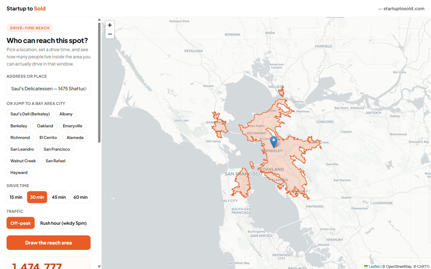
Someone doing market research needed to know how many people lived within a drive of a Bay Area location, and who those people were. A straight-line circle on a map is useless. So I built a tool that draws the real drive-time area, with traffic, and counts the actual population inside it. Built in a day.
Try It YourselfEnter an address, pick a drive time, and the map draws the real reachable area and counts the people inside it. Here it is centered on Berkeley at a 30-minute drive.
Most "radius" tools draw a straight-line circle and call it reach. But nobody drives in a straight line. This tool uses real road networks and traffic, then pulls actual census data for the area it draws.
This is the kind of analysis that companies pay thousands a year for through enterprise GIS platforms. I stitched it together from a traffic-aware routing service and live census data, wrapped it in a clean map, and put it on the internet in a day, running for almost nothing.
Try one of the Bay Area presets, or type in your own address anywhere in the US. The best way to understand what I can build is to use something I've built.
Open the Reach Map →Every business has a question that a custom tool could answer in seconds. I find the question, pull in the data, build the tool, and deploy it. What could yours look like?
Book a callOr email chuck@startuptosold.com